


Pennyrile Area Development District (South) PUMA, Kentucky
About
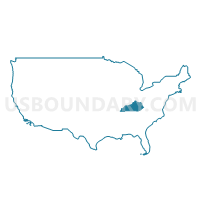
Outline
+PUMA%2c+Kentucky_A280.png)
Summary
| Unique Area Identifier | 192990 |
| Name | Pennyrile Area Development District (South) PUMA |
| State | Kentucky |
| Area (square miles) | 1,838.96 |
| Land Area (square miles) | 1,747.27 |
| Water Area (square miles) | 91.68 |
| % of Land Area | 95.01 |
| % of Water Area | 4.99 |
| Latitude of the Internal Point | 36.87712200 |
| Longtitude of the Internal Point | -87.61075370 |
Maps
+PUMA in Kentucky.png)
Graphs
Select a template below for downloading or customizing gragh for Pennyrile Area Development District (South) PUMA, Kentucky
+PUMA%2c+Kentucky_T0.png)
+PUMA%2c+Kentucky_T1.png)
+PUMA%2c+Kentucky_T2.png)
+PUMA%2c+Kentucky_T3.png)
+PUMA%2c+Kentucky_T4.png)
+PUMA%2c+Kentucky_T5.png)
+PUMA%2c+Kentucky_T6.png)
+PUMA%2c+Kentucky_T7.png)
+PUMA%2c+Kentucky.png)
Neighbors
Neighoring Public Use Microdata Area (by Name) Neighboring Public Use Microdata Area on the Map
- Barren River Area Development District (Outer) PUMA, KY
- Montgomery & Stewart Counties--Clarksville City PUMA, TN
- Pennyrile Area Development District (North) PUMA, KY
- Purchase Area Development District PUMA, KY
- Robertson, Dickson, Cheatham & Hickman Counties PUMA, TN
Top 10 Neighboring County (by Population) Neighboring County on the Map
- Montgomery County, TN (172,331)
- Christian County, KY (73,955)
- Robertson County, TN (66,283)
- Hopkins County, KY (46,920)
- Calloway County, KY (37,191)
- Muhlenberg County, KY (31,499)
- Marshall County, KY (31,448)
- Logan County, KY (26,835)
- Trigg County, KY (14,339)
- Stewart County, TN (13,324)
Top 10 Neighboring County Subdivision (by Population) Neighboring County Subdivision on the Map
- Hopkinsville CCD, Christian County, KY (40,644)
- District 1, Montgomery County, TN (15,902)
- District 18, Montgomery County, TN (15,713)
- Russellville CCD, Logan County, KY (14,754)
- Calvert City CCD, Marshall County, KY (14,249)
- Fort Campbell CCD, Christian County, KY (13,685)
- Greenville CCD, Muhlenberg County, KY (11,892)
- Princeton CCD, Caldwell County, KY (10,909)
- Oak Grove-Pembroke CCD, Christian County, KY (10,606)
- District 10, Montgomery County, TN (7,514)
Top 10 Neighboring Place (by Population) Neighboring Place on the Map
- Clarksville city, TN (132,929)
- Hopkinsville city, KY (31,577)
- Fort Campbell North CDP, KY (13,685)
- Oak Grove city, KY (7,489)
- Dawson Springs city, KY (2,764)
- Cadiz city, KY (2,558)
- Eddyville city, KY (2,554)
- Elkton city, KY (2,062)
- Guthrie city, KY (1,419)
- White Plains city, KY (884)
Top 10 Neighboring Unified School District (by Population) Neighboring Unified School District on the Map
- Montgomery County School District, TN (166,179)
- Robertson County School District, TN (66,283)
- Christian County School District, KY (60,270)
- Hopkins County School District, KY (44,301)
- Muhlenberg County School District, KY (31,499)
- Marshall County School District, KY (31,448)
- Calloway County School District, KY (26,537)
- Logan County School District, KY (20,760)
- Trigg County School District, KY (14,336)
- Fort Campbell Dependent Schools, KY (13,688)
Top 10 Neighboring State Legislative District Lower Chamber (by Population) Neighboring State Legislative District Lower Chamber on the Map
- State House District 68, TN (85,127)
- State House District 66, TN (66,283)
- State House District 78, TN (66,061)
- State House District 75, TN (62,143)
- State House District 6, KY (41,978)
- State House District 5, KY (41,952)
- State House District 8, KY (41,126)
- State House District 4, KY (39,505)
- State House District 16, KY (39,295)
- State House District 15, KY (38,558)
Top 10 Neighboring State Legislative District Upper Chamber (by Population) Neighboring State Legislative District Upper Chamber on the Map
- State Senate District 18, TN (222,166)
- State Senate District 22, TN (219,862)
- State Senate District 24, TN (184,244)
- State Senate District 1, KY (113,784)
- State Senate District 3, KY (113,250)
- State Senate District 4, KY (106,696)
- State Senate District 2, KY (105,262)
- State Senate District 6, KY (102,261)
Top 10 Neighboring 111th Congressional District (by Population) Neighboring 111th Congressional District on the Map
- Congressional District 7, TN (792,605)
- Congressional District 6, TN (788,754)
- Congressional District 1, KY (686,989)
- Congressional District 8, TN (658,258)
Top 10 Neighboring Census Tract (by Population) Neighboring Census Tract on the Map
- Census Tract 1013.03, Montgomery County, TN (7,913)
- Census Tract 2013.02, Christian County, KY (7,507)
- Census Tract 9702, Trigg County, KY (6,789)
- Census Tract 402, Livingston County, KY (6,545)
- Census Tract 1102, Stewart County, TN (6,544)
- Census Tract 9601, Lyon County, KY (6,444)
- Census Tract 9506, Marshall County, KY (6,308)
- Census Tract 2007, Christian County, KY (6,224)
- Census Tract 2009, Christian County, KY (6,073)
- Census Tract 802, Robertson County, TN (5,943)
Top 10 Neighboring 5-Digit ZIP Code Tabulation Area (by Population) Neighboring 5-Digit ZIP Code Tabulation Area on the Map
- 37042, TN (66,916)
- 37040, TN (44,924)
- 42240, KY (42,479)
- 37043, TN (39,945)
- 42071, KY (29,655)
- 42223, TN (19,837)
- 42025, KY (19,305)
- 42276, KY (14,471)
- 42211, KY (13,422)
- 42345, KY (11,747)